Any information, fact or statistic that may be gathered, examined, and evaluated is referred to as data. It has evolved into a crucial tool for businesses to make informed decisions and gain a competitive advantage. Businesses utilize data to find trends, patterns and insights that will help them create effective strategies, enhance their productivity and boost income. Businesses continuously gather and analyze data, from consumer demographics to sales figures, to inform their decision making. Success in every industry requires the capacity to properly manage and use data in today’s data-driven world. The potential of geospatial data analysis in market research has attracted increasing attention in recent years. In this article, we will discuss the meaning, benefits of using Geospatial Data for Business.
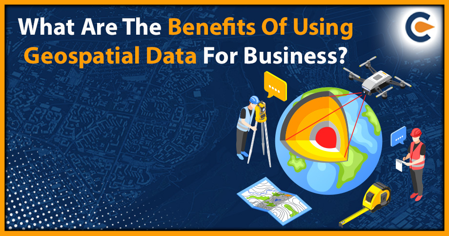
What Do You Mean By Geospatial Data?
Geospatial data refers to information tied to a specific location on the earth’s surface. This data is typically collected using various technologies such as satellite imagery, aerial photography, GPS tracking and mapping software. Geospatial data can provide insightful information and context for various applications, from urban planning and environmental monitoring to business analytics and marketing.
Geospatial data can be used to visualize, analyze, and understand patterns and relationships between factors such as population density, land use, weather patterns and natural resources. This information can help individuals and organizations make more informed decisions about everything from where to locate a new business to how to respond to a natural disaster.
The availability of geospatial data has greatly risen in recent years as a result of technological advancements and the expansion of sources for gathering and exchanging this data. As a result, geospatial data has emerged as a crucial tool for various sectors, including telecommunications, agriculture, transportation, and energy. Geospatial data for business is a term used to describe the information that includes location or geographic coordinates. The data can then be utilized to make maps, visualize data and spot trends in relation to a particular place. Businesses can gain insights about their operations, consumers, and markets utilizing geospatial data that would be impossible to find using conventional data analysis techniques.
Applications of geographic data in business include personalizing marketing strategies, finding new market opportunities, and improving supply chain routes. By examining their location data, geospatial data can also assist businesses in better understanding customer behaviour and preferences.
The availability of data and technological advancements in recent years have led to considerable growth in the use of geospatial. Geospatial data for business is becoming more abundant, diverse and accessible as a result of the development of the Internet of Things (IoT) and the rising popularity of mobile devices. Geospatial data for business is becoming a more critical tool to get a competitive edge and make informed decisions.
Benefits of Using Geospatial Data for Business
Following are the benefits of using Geospatial Data for business:
- Increased Efficiency
Businesses now depend heavily on geospatial data as a tool to improve productivity. One of the primary ways that geospatial data increases business efficiency is by providing location-specific information. Businesses can learn more about a particular geographic area’s population density, transportation patterns, and consumer behaviour by examining geospatial data. Businesses can use this information to streamline supply chain management, improve the effectiveness of their marketing efforts, and optimize operations.
For example, a logistics company can use geospatial data to optimize their delivery routes by analyzing traffic patterns and identifying the most efficient routes to take. Similarly to this, a retail business can use geographical data to determine which areas, based on consumer behaviour and population density, are best suited for new store locations.
In addition, geospatial data for business can be used to monitor and track assets and equipment. By using sensors and other geospatial technology, businesses can track the location and movement of their assets, allowing them to optimize their use and reduce downtime.
- Improved Decision-Making
Geospatial data for business provides a visual representation of their operations. This enables businesses to see patterns and trends that may not be apparent through other forms of data. For instance, mapping customer locations and purchasing patterns can help businesses identify areas of high demand and adjust their marketing strategies accordingly. Additionally, visualizing the location of competitors can help businesses identify potential areas of growth and make decisions on where to invest resources.
Geospatial data for business helps to understand the context of their operations. By analyzing the environment surrounding their operations, businesses can make informed decisions on how to allocate resources. For instance, geospatial data can help businesses identify the best locations for new stores or offices based on factors such as customer demographics and traffic flow.
Geospatial data can assist companies in streamlining their operations. Businesses can decide how to optimize their operations and cut expenses by examining supply chain networks and transportation routes. For instance, traffic pattern analysis can assist companies in improving delivery routes to cut down on travel time and expenses.
- Enhanced Customer Experience
With the increasing use of technology, businesses are now able to leverage geospatial data to enhance their customer experience. Personalized Marketing Geospatial data for business allows to target customers based on their location. By using data such as the customer’s zip code, businesses can send personalized marketing messages that are relevant to their location. For example, a restaurant can send out promotions for their nearby location to people living within a certain radius.
In order to improve delivery and logistics and provide faster and more effective service, geospatial data can also be used. To find the quickest and most effective routes to deliver their goods, delivery businesses can use geospatial data. This results in quicker deliveries and satisfied customers. Geospatial information can help consumers find their way around more easily. For instance, a mall can offer digital maps that guide customers to the stores they want to visit and show them where they are in the mall. Customers will have a better purchasing experience overall and feel less frustration as a result.
Geospatial data for business can be used to provide real-time alerts to customers. For example, a transportation company can use geospatial data to provide customers with real-time updates on the location and the estimated time of arrival of their vehicle.
- Competitive Advantage
Having access to geospatial data for business can give you a substantial competitive advantage in the commercial world of today. By offering insights into customer behaviour, geospatial data can assist firms in gaining a competitive edge. Businesses can learn more about their consumers by analyzing data such as purchasing patterns, demographic data, and location data. The consumer experience can be enhanced overall, and targeted marketing campaigns and customized promotions can be developed using this data.
Another way that geospatial data can help businesses gain a competitive advantage is through better supply chain management. By analyzing geospatial data, businesses can optimize logistics and distribution, resulting in more efficient operations and reduced costs. This can lead to improved product availability, faster delivery times, and, ultimately, increased customer satisfaction.
Businesses can also use geospatial data to find fresh market prospects. Businesses can design targeted marketing strategies to reach locations where there is a high demand for their goods or services by analyzing geospatial data to find those places. This could aid businesses in growing their clientele and revenue.
- Risk Management
In all industries, geospatial data for business is essential for risk management. To give a complete picture of the physical environment, this information is gathered through satellites, sensors, and other sources. Businesses can detect possible risks and create plans to mitigate them by utilizing geospatial data.
Identifying natural hazards is one way geospatial data aids in risk management. This covers events like hurricanes, wildfires, earthquakes, and floods. Businesses can assess the frequency and severity of these threats in particular places by examining geospatial data. When deciding where to build or locate infrastructure or when creating emergency response plans to lessen the effects of a disaster, this information can then be used to make informed judgments.
Geospatial data for business can also be used to manage man-made risks, such as those associated with infrastructure or supply chains. For example, businesses can use geospatial data to identify areas where critical infrastructure may be at risk from natural hazards or other threats. They can then develop contingency plans to ensure that operations can continue in the event of a disruption.
In addition to mitigating risks, geospatial data can also help businesses prepare for them. By analyzing historical data and predicting future trends, businesses can anticipate potential risks and develop strategies to minimize their impact. This could include changing supply chain routes or developing alternative manufacturing processes that are less susceptible to disruptions.
Challenges of Using Geospatial Data for Business
Although using geospatial data for business provides valuable insights into local trends and patterns, various challenges come with its usage.
- Ensuring the quality of geospatial data is one of the biggest challenges to using it in business. The quality of the source data, such as satellite images, aerial photographs, or street maps, determines how accurate geospatial data is. Data inaccuracies, such as missing or out-of-date information, can result in inaccurate analysis and judgment. The data must therefore be validated and verified before being used for business purposes.
- Integrating geospatial data with other data sources, such as customer, a sale, or inventory data, is another challenge. Especially when dealing with significant amounts of data from many sources, integration of these datas can be challenging. It takes a lot of time and knowledge to make sure the data is accurate and consistent. Integration can be difficult since geospatial data might come in a variety of formats.
- Data privacy is another key concern while utilizing geospatial data. Geospatial data may include sensitive information that could compromise someone’s privacy and get into the wrong hands, such as the location of the person. When collecting and using geospatial data, businesses must make sure they abide by all applicable privacy laws, including the Central Consumer Protection Authority (CCPA) and General Data Protection Regulation (GDPR). They also need to take the proper precautions to secure the data, such as encrypting it and only allowing authorized individual’s access.
- The need for specialized knowledge and equipment for analyzing and interpreting geospatial data is another challenge. Technical expertise in Geographic Information Systems (GIS) and programming languages, as well as domain-specific knowledge, is needed for geospatial analysis.
Real-World Examples of Geospatial Data in Business
Uber is among the most well-known users of geospatial data in business. Uber matches drivers and riders, determines surge pricing, and optimizes routes using geospatial data. Uber’s capacity to deliver a seamless and effective service to millions of users globally is made possible by real-time analysis of data on traffic patterns, demand, and driver availability. Additionally, Uber uses geospatial data to pinpoint regions where there is a significant demand for its services, enabling the firm to expand its operations strategically.
Starbucks is another company that has successfully integrated geospatial data into its business strategy. Starbucks uses geospatial data to identify the best locations for its stores, analyze customer behaviour, and optimize store layouts. By analyzing demographic data, foot traffic, and customer preferences, Starbucks is able to create personalized experiences for its customers. Starbucks also uses geospatial data to optimize its supply chain, ensuring that its stores are well-stocked with the products that customers want.
Conclusion
For companies looking to survive and prosper in today’s marketplace, geospatial data is a valuable resource for them. Many advantages result from the ability to analyze and interpret data depending on location, including better decision making, higher efficiency, and improved consumer engagement. However, using geospatial data effectively comes with its own set of challenges. It is crucial for businesses to address these challenges and ensure that they are using geospatial data in an ethical and responsible manner. Looking ahead, the potential of geospatial data for business is enormous, and we can expect to see continued growth in its use and importance in the years to come. By investing in the right tools and strategies, businesses can take advantage of geospatial data to gain a competitive edge and achieve their goals.
Also Read:
Environmental Audit Checklist